PH microsatellites send first images from space
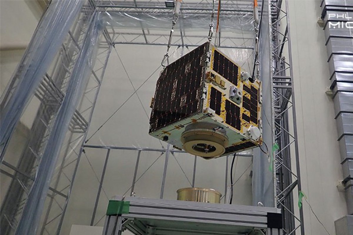
Diwata-2, a microsatellite built and designed by Filipinos, has successfully captured and transmitted images less than a month after its launch last October 29, 2018.
The microsatellite was built by the Philippine Scientific Earth Observation Microsatellite (PHL-Microsat) Program, the country’s first initiative in developing our capacity in space science and technology. It is funded by the Department of Science and Technology (DOST), and done through the collaboration between the University of the Philippines Diliman, the DOST-Advanced Science and Technology Institute (ASTI), and Japan’s Hokkaido University and Tohoku University.
The images are part of the initial testing and calibration phase of Diwata-2’s cameras. Among the images captured are a portion of the Earth, as well as some parts of the provinces of Aurora and Kalinga.
In a blog post, PHL-Microsat explains that the satellite will help monitor targeted areas for assessment of crops, coastal areas, and on demand image acquisition on areas hit by disasters due to having “fixed revisit intervals.” They add that the microsatellite will stay in orbit for 3 to 5 years, making it potentially last longer than their first microsatellite, the Diwata-1.
The Earth, through Diwata-2’s eyes
The image shared by PHL-Microsat was captured using the the microsatellite’s Wide Field Camera (WFC), taken on November 6, 2018, at 1:36 p.m. The image shows large cloud patterns above the South China Sea.
Kalinga’s Rice Paddies
The High Precision Telescope (HPT) of Diwata-2 captured an image of Kalinga’s Tabuk City, on November 14, 2018, at 1:09 p.m. The upper right hand corner of the image shows the rice paddies of Barangay Bulo, during the second harvest season.
Diwata-2’s orbit allows the acquisition of several images within a cropping season, which will be used to determine the stages of crops and estimating potential yields, as well as in assessing the damage of potential disasters such as flooding or drought.
Aurora’s Coast
Diwata-2’s Spaceborne Multispectral Imager (SMI) captured an image of Aurora Province, particularly the Casiguran municipality, the coast of Dinalungan and Dipaculao, Baler Bay, and the Casiguran Sound. These types of images can be used to assess coastal conditions, which are key indicators for water quality, ecological health, and resource management.
Third successful launch
Diwata-2 is the program’s third successful launch, after the Diwata-1 and a nanosatellite, Maya-1. The PHL-Microsat is succeeded by another program, the Space Technology and Applications Mastery, Innovation and Advancement (STAMINA4Space), which is aimed to further developing expertise in space technology and applications, and to sustain the growth of a local scientific-based industrial base. STAMINA5Space intends to contribute to building a resilient Filipino society through science-based policies and programs that are supported by innovations in space technology.
Images from Diwata-1 and Diwata-2 can be seen here on PHL-Microsat’s website.