Advocates Warn Metro Manila’s Floods Have Nowhere to Go
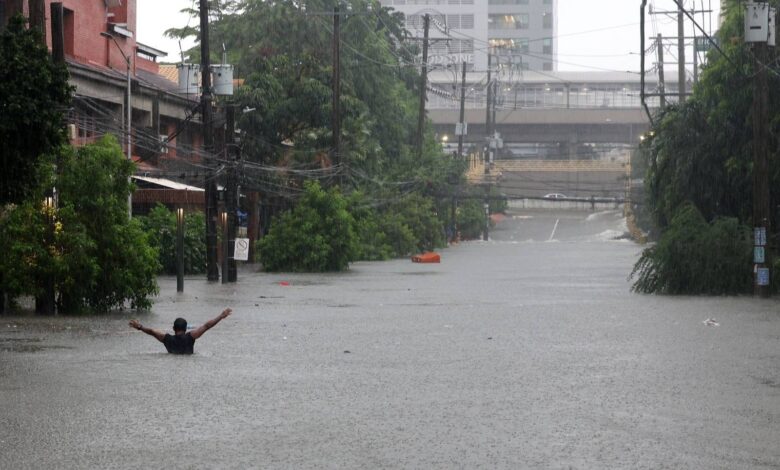
Metro Manila’s recurring flood crisis reveals a gap in how the city thinks about water management. While government agencies invest in pumping stations, river dredging, and drainage systems, a quieter problem persists: the infrastructure designed to move water out of residential areas often has nowhere to discharge it.
The issue centers on what flood engineers call “terminal velocity” or the final destination where stormwater is supposed to exit the urban system.
For southern Metro Manila, that destination is Manila Bay. But the path between communities and the bay is increasingly contested.
The Infrastructure Disconnect
Floodwater moves through a designed hierarchy: residential areas → drainage systems → esteros and tributary rivers → major rivers → Manila Bay. Any break in this chain creates backups.
The challenge goes beyond the obvious culprits. While clogged drainage systems worsen flooding, waste management gaps also play a role. So do physical barriers that interrupt the natural discharge pathway.
Waterways like the Molino, Zapote, Las Piñas, and Parañaque rivers have traditionally served as the city’s pressure release valve. But decades of reclamation projects along Manila Bay have progressively narrowed these discharge corridors, according to environmental and flood management experts.
Development Versus Drainage
This creates a fundamental tension: as the city expands, reclamation projects add land for commercial and residential development. But every hectare of reclaimed land potentially reduces the volume and speed at which water can exit the urban system.
Reclamation in flood-prone areas is particularly contentious because it operates on a time horizon measured in decades. Development plans and property value appreciation drive these projects forward, while their impact on flood dynamics is immediate and compounds with every subsequent storm.
Wetlands and Natural Buffers
Another overlooked piece of flood mitigation sits in the Las Piñas-Parañaque Wetland Park, a designated Ramsar wetland. Wetlands and mangrove forests function as natural shock absorbers for storm surge and help regulate water movement along the coastline.
When wetland areas shrink or degrade, nearby communities lose both storm protection and the ecological infrastructure that supports water’s movement toward the sea.
READ: Metro Manila Needs Its Wetlands as Calamities Strike
What Integrated Looks Like
Treating flooding as solely an engineering problem (more pumps, more dredging, more drainage) misses the systemic picture. Cities that have reduced flood vulnerability typically combine multiple strategies:
- Waste management and estero maintenance to keep discharge pathways open
- Drainage and pumping infrastructure scaled to actual water volumes
- River maintenance that removes sediment and debris
- Wetland and coastal ecosystem protection to maintain natural water pathways
- Evaluation of development projects for their impact on water flow
The gap isn’t in understanding these components individually. It’s in whether they’re actually coordinated. Pumping stations fail to reduce flooding if drainage systems feeding them are clogged. Dredging has limited effect if water has nowhere to go once rivers reach the bay. Wetland protection matters only if decisions about reclamation account for it.
The Broader Question
As Metro Manila continues to densify and expand, the city faces a choice embedded in its development decisions: whether new construction prioritizes water flow or land maximization. Those aren’t always compatible.
For communities in flood-prone areas, the answer determines whether they’re safer or more vulnerable in the next typhoon season, regardless of how many new pumping stations get built. Environmental advocates have long warned that reclamation projects threaten both flood management and coastal ecosystems, concerns that remain unaddressed as the city continues to expand seaward.